
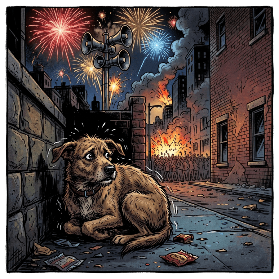
Mr Richard Feder stumbles into Cal’s Coffee Shop with his hands over his ears. “Holy Pete, those fireworks were loud! They pulled out all the stops with that finale. BAM! BaBANG! BAMBAMBAM!! I’m still jazzed, see, I’m shaking. My dog back home’s hiding under the bed.”
Cal shoves a mug at him. “Try some of this.”
“Smells like a bakery. What is it?”
“It’s called chai. Just some spices and decaf tea. Supposed to be calming.”
<sips> “Hmm. … Yeah, seems to be working. Still can’t get over the impossible noise level, though. Had to be hundreds of decibels.”
I’m over here nursing my usual cup of mud. “Several hundred decibels can’t happen on Earth.”
“Hey, I was right there, I heard it, I felt it!”
“What you felt wasn’t sound, and it’s not measured in decibels.”
“Sounded like sound.”
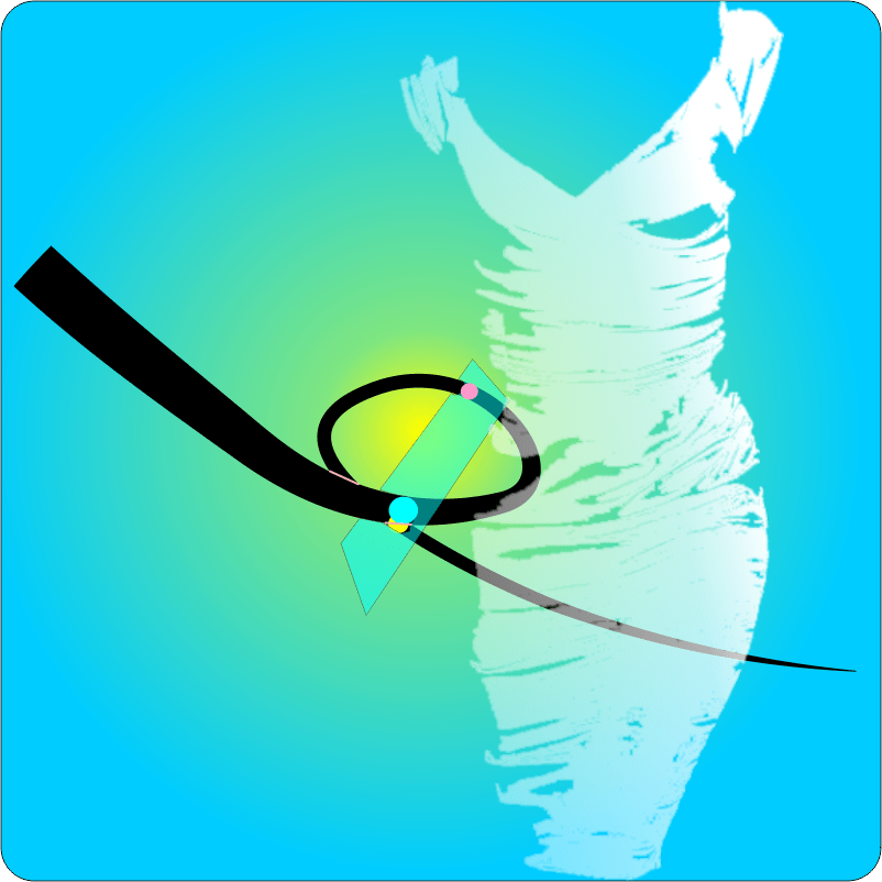
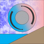
<sketching on Old Reliable> “Sound is a continuous wave of out‑and‑in pressure changes, like the orange line here. The variation is what matters — push and pull, the waves average out to atmospheric pressure. What you felt was a shock front, a quick pulse of high pressure, all outward like the red line. OK, you felt a bunch of shock fronts, but not the regular waves that decibels care about.”
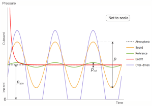
“What’s the green line about? It’s regular.”
“That stands as a baseline for comparisons. I’ve marked its high‑low range as pref. Most people doing sound measurements set pref to the smallest pressure swing that most people can hear, about 2×10⁻¹⁰ atmospheres—”
“That’s pretty small.”
“Indeed, but you’ve got to start somewhere. If you whisper to a partner at exactly that sound wave level, p=pref, the p/pref ratio is 1.0. That’s zero on the bel scale. Sounds from rustling leaves have a p/pref ratio about ten times larger. We give that a two‑bel rating. Every factor of ten above that rates an additional two bels. A busy nightclub could easily have a p/pref ratio near 105, ten bels, a hundred thousand times more pressure swing than your quiet whisper.”
“What’s that got to do with decibels?”
“They’re for rating sound waves that are between ten‑factors. ‘Deci-‘ means one‑tenth so there’s ten decibels per bel. The noise police would assess that ten‑bel nightclub at 100 decibels. If you sit right next to the loudspeakers where the sound pressure is 120 decibels, the extra 20 decibels pummel your eardrums with an extra ten times the pressure swing. Which is why people suffer short-term hearing loss at that intensity.”
“Uhhh… so 300 decibels from those fireworks would be a 1015 ratio which is a lot but why do you say it’s impossible?”
“That’s what the blue ‘Over‑driven’ line is about. Suppose you give an alarm siren a continuously growing power feed. As the siren’s power increases, it emits pressure peaks that push out more strongly and valleys that pull in more strongly. When the valley’s part of p eventually grows to atmospheric pressure patm, the sound’s pressure valleys try to drop below zero, which they can’t because zero is is a vacuum. Further output power beyond that level only goes to the outward pressure phase. The siren isn’t making a sound any more, it’s making push pulses. Maximum loudness happens when the p/pref ratio nears patm/pref. On Earth, patm/pref is 5×10⁹. If you do the math, that’s 194 decibels. You just can’t make a sound any louder than that, no matter how you modify the siren.”
“You said ‘on Earth’ twice, like the limit’s different on other planets?”
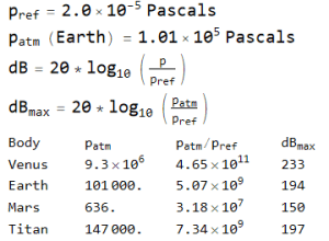
“Sure. The same formula applies to any body with a solid surface and an atmosphere. The Solar System has only three planets and one moon that qualify. Here, I’ll tell Old Reliable to run the numbers for those. … How about that? Earth’s ‘loudest possible sound’ almost exactly matches the one for Saturn’s moon Titan. Mars is 40 decibels quieter than we are, but Venus is 40 decibels louder.”
“Dogs got sensitive ears. I bet they’d like it on Mars. They’d probably invent a different bel scale, though.”

~ Rich Olcott


